There is so much to do in the New Hampshire seacoast area. The list of things to do grows every year. Towns are buying/inheriting conservation areas for an easy scenic walk. There is more than beaches and good restaurants in the area. This blog is to present these activities. I will also promote historic places. There is more history than people can imagine. There are concerts playing all summer long. I can go on describing what to do. You can read the posts. The posts will include hiking paths, historical sites and other sites. Here we go.
Hiking In New Hampshire
I was driving along the coast and I saw a patch of conservation land owned by SELT (Southeast Land Trust of New Hampshire). I have seen this name before. One with the Awcoming Marsh and group of trails associated Stratham Hill Park. I went to the SELT website and found a group of additional trails. The web site is https://seltnh.org/trails/ . There are handouts that are printable or you can just read them. In the handouts there are trails which described the trail. The trails are from easy to moderate challenge, and all have a view. There are enough trails that will keep you busy.
Great Bay National Wildlife Refuge
I just finished a doctor’s appointment at Pease Base in Newington NH. It was early afternoon and looking for something to do. I remembered a national refuge that had a few trails. From the entrance to the reserve center, there was Arboretum Rd. I followed that road to a rotary. I notice that Woodbury ave stopped at the rotary. I followed West Arboretum rd through wood until I reached the end. There was a parking lot and an information board. The map showed two trails.
I decided to go down the shorter trail. The name was Peverly Pond Trail. It was about a half mile long. It was a walk through the woods. The trail was on a wooden path.

I reached a point where another trail cut off. It was short. One can see the end of the trail. I followed the trail and found a small platform overlooking a pond.
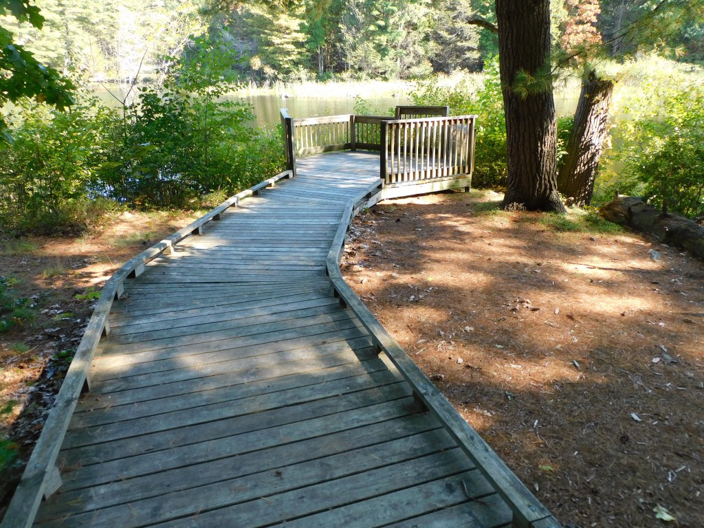
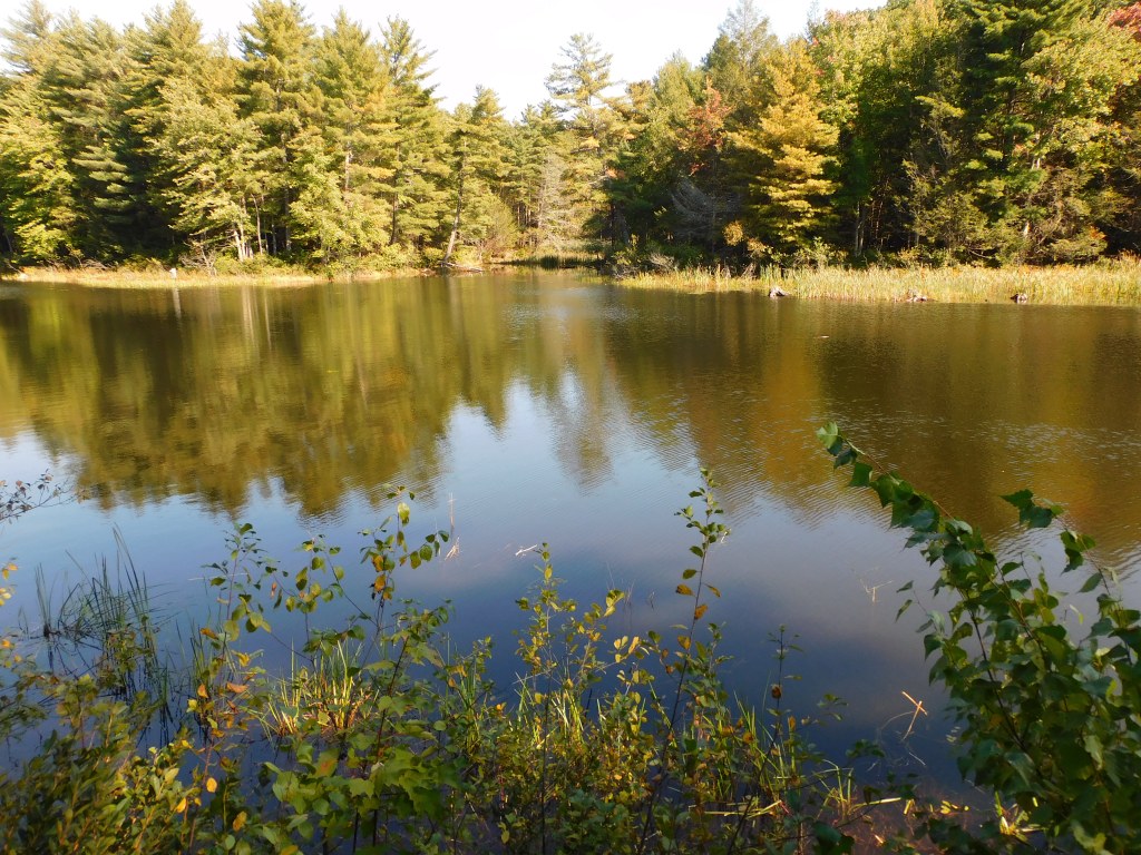
I spent some time enjoying the view from the platform and then continued the walk. It was amazing that the entire trail is wooden. On the way coming back I saw two deer. I was not able to enjoy looking at them too long for they were easily spooked.
At the end of the trail, I came back to the information stand.
From there I walked across the street and started the other trail. It is 9 miles long and went to Great Bay. It is called the William Furber Ferry Way Trail. The trail is well taken care of. It is a trail that goes through woods and a field. After about a mile, ones reach a split. It doesn’t matter which way you go because you will return from the other direction. I picked going across the wooden bridge. Keep walking and eventually you reach Great Bay. Going along the great bay coast, you will find a platform next to the water. There is a scope on the platform that gives you a clear view of Great Bay.

I continued walking. On the trail, there was seats to rest. Whether you need them is up to you. It was a beautiful afternoon walk. Even if you are not tired, it is nice to sit and look around. I eventually reached the end. I felt good as I was leaving in my car.
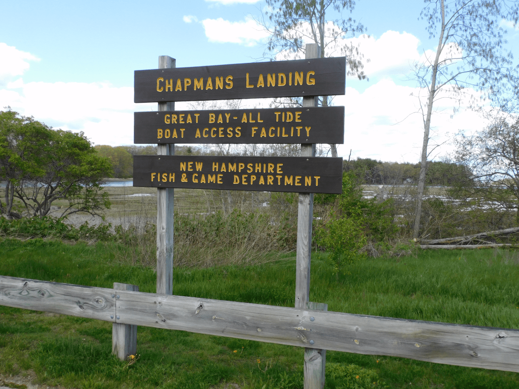
Chapmans Landing
One of my favorite places to let in my kayak is this place. If you go down the river you reach Great Bay. If you go the opposite direction, you reach Exeter where you can dock the kayak and walk around. There was other places to walk to explore. I never walk around until recently. I found a real treasure.
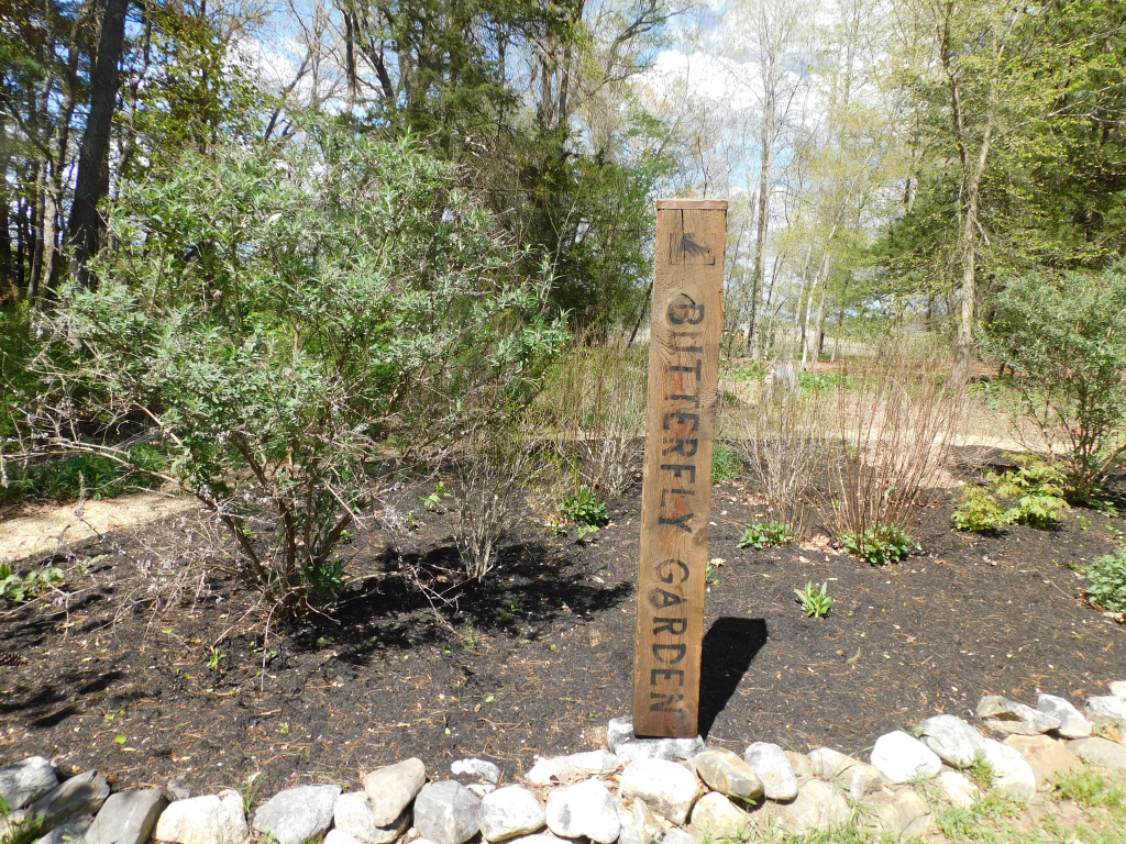
It was a well kept group of gardens with an overlook to Great Bay. One of the gardens was plants that attract butterflies. They had about 6 other gardens with different functions. It was before the gardens bloom so I could not show a fully function group of gardens. I will go there this summer to see the gardens in full bloom.
Another feature is a place to look at the marsh land. In the distance is Great Bay. There is a functional telescope on the platform. It is known that there is good bird watching there.
There is also a small side trail that goes under the bridge. It doesn’t lead anywhere only the view under the bridge.
One last thing. I saw something there that I have never seen before. They had a dog lease at the entrance. They ask that after you finish using the lease, you put it back where you found it.


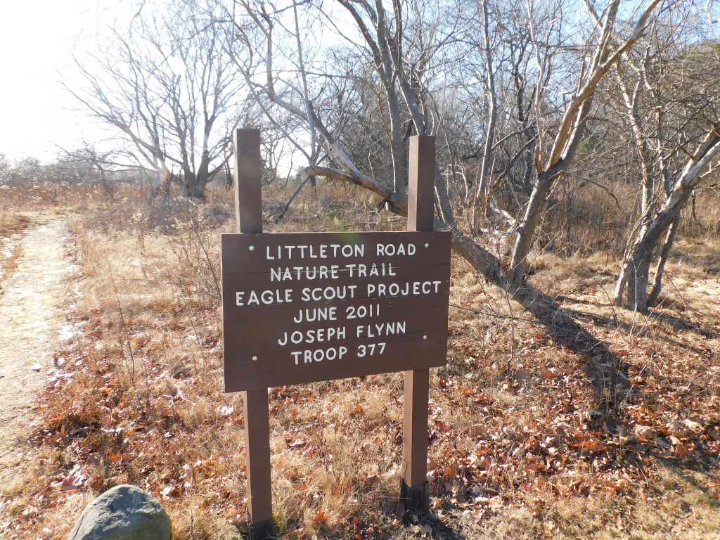
Newington Town Woods
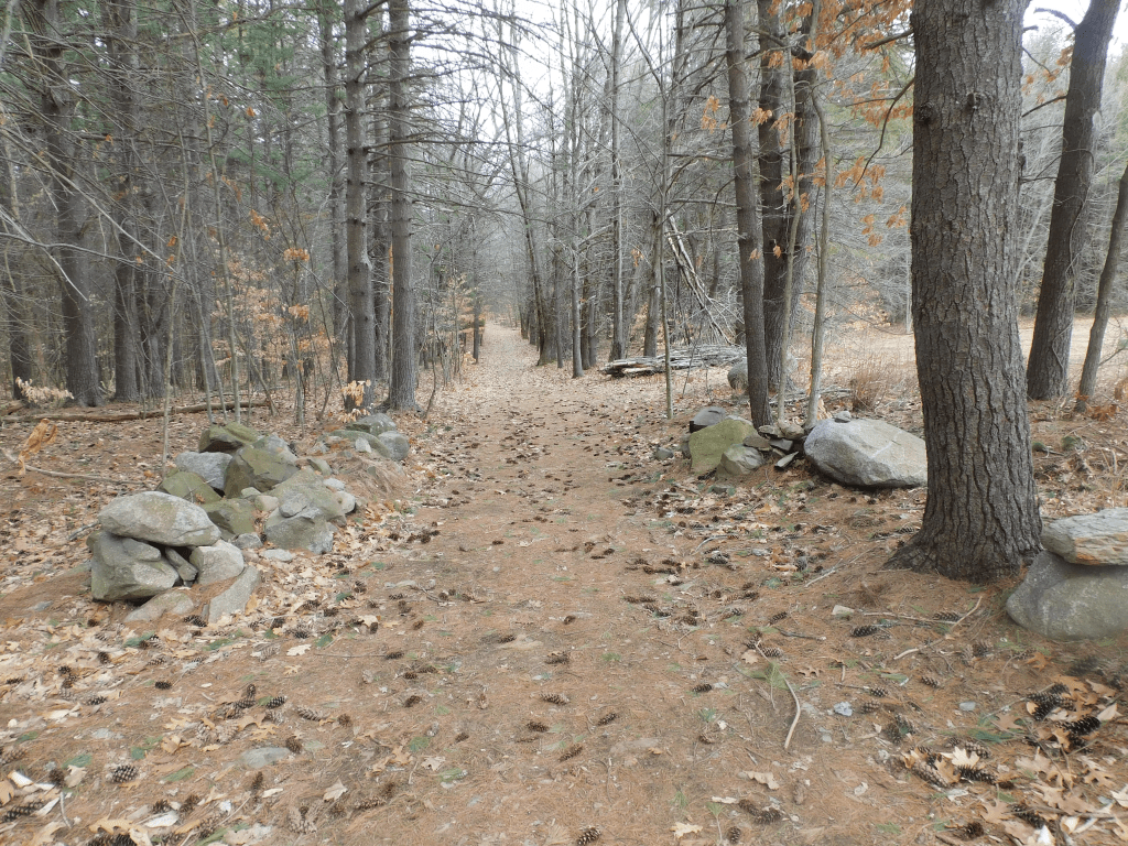
When one mentions Newington NH, one thinks of shopping malls and commercial land of restaurants and businesses. When one explores the town, you find an incredible wealth of conservation land. I visited the historic area. There was a few buildings that were built in the early 1800’s and late 1700’s. None was open because of the pandemic. The road to get there is Nimble Hill road.
I did find a nice surprise. There was a trail that takes you through the United States oldest woods. To be an afficial woods, it has to be over a certain acreage. When it was registered in the early 1800’s, the size met the requirement. For a while during the cold war, the United states annex some of the woods to be part of Pease Air Force Base. When Pease closed, the land was given back to Newington.
I parked my car close to the start of the trail. The trail was wide and well taken care of. To the left of me was private property. To the right was woods where there was periodic offshoot trails. Continue on and you reach Arboritom Road which takes you to another trail upkeeped by the Fedderal Park system. I will talk about that in another entry.
I went back to the car after having a good walk. A good web site to read prior to walking this trail is Newington Center Historic District, Newington Town, Rockingham County, Newington, NH, 03801 (livingplaces.com) This also descibes the other boildings of the historic district.


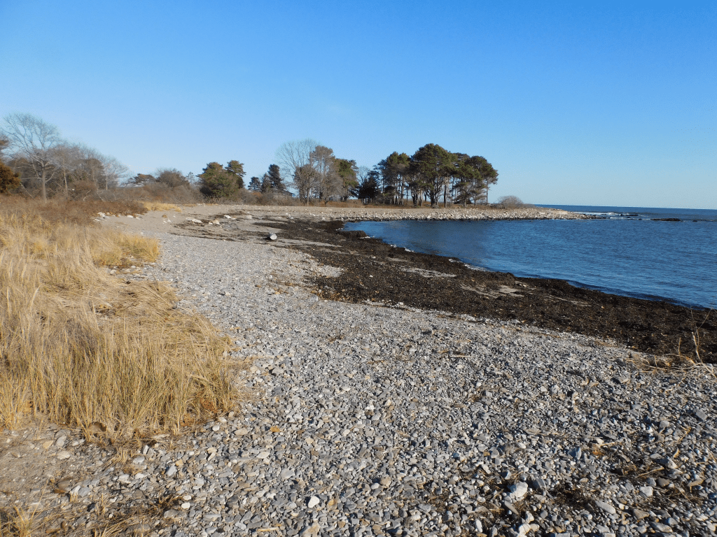
Odiorne Point – Scientific
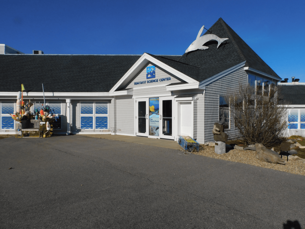
Ordiorne point is a perfect place as to perform research projects. On the northern portion of the point there was a place to lauch ships. I heard from scuba divers that the water is very clear. It is a good central location in which to partnership with the Isle of Shoals for research projects in the ocean. There are other scientific projects to perform. There is a science center as heaquarters for these projects.
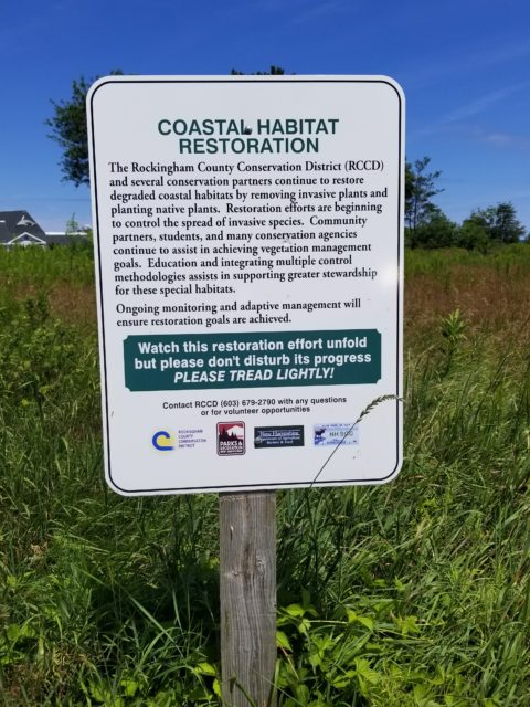
One of these projects is to eliminate intrusive plants that have overtake original vegetation. These plants are like oriental bittersweet and buckthorn. These plants were planted to hide the guns put there to defend the harbor. There are signs throughout the park signifying this.
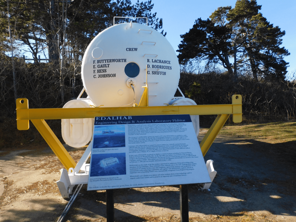
There are also research projects for the ocean. As you go from the parking lot to the Seacoast Science Center on the left is a strange looking ocean vehicle. It is a ocean habitat that allows divers to stay under water for more than one day. It is fenced off to protect it.
There is a building that includes much of research projects the researchers were and are involved in. It is small but packed with learning stimulatous. There is much to learn. There is a tank to put your hands in to touch some of the sea life. There is also a skelton of of a small whale on the ceiling. One can spend hours there. I saw in the internet where they are taking care of an injured seal.
They work in partnership with Isle of Shoals and UNH. This is a quick summary of what they do for research. Here is more information. Odiorne Point State Park – Seacoast Science Center, NH State Parks : Welcome, Odiorne Point State Park – Wikipedia
Odiorne Point – History
We have at least 3 posts for this blog for Odiorne point. If your interests include history, walking, boating or scientific adventures there is something of interest for you. This post is about the history of the area. Sometimes I wonder when I should start. The history is so diverse. I would love to take a time machine and see what the land looked like at different times. I see historical artifacts that I can’t explain and I can’t find someone to explain it to me. This post is about the history of the area.
Lets first look at the ice age. During the ice age the water had receded back to the Continental shelf. During that time a forest grew of what is now off the coast. The forest extended off the entire coast of New Hampshire. When the ice melted the water level raised to the level it is now flooding the forest. The forest became petrified. There is a cove on the southern portion of the point. During low tide, if you look closely you can see remnants of the petrified forest. It won’t be obvious.
Millions of years later ice melted and brought the water level to close what it is now. The forests were flooded and became petrified. Without a grasp of what previous happened, the Indians came to the point for recreation and food. There was fish , clams and mussels to eat. The Indians called this area Pannaway.
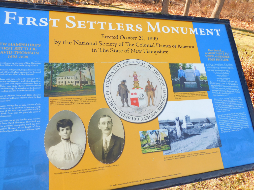
Let us look ahead further to the year 1632. This is the year when New Hampshire was first entered by Europeans. They came by ship and landed at a protruding portion of land at Odiorne point. They did not find it. A few years before the shore line was mapped by John Smith. This was the same John Smith whose life was saved by Pocahantas. He was more concerned by Isle of Shoals. If fact he name those island Smith Island and notified that of all the land that he visited in the New World he asked for ownership of the Islands. He did not live long enough to actually take control over the Island. In 1660, John Odiorne settled in the land and farmed it.
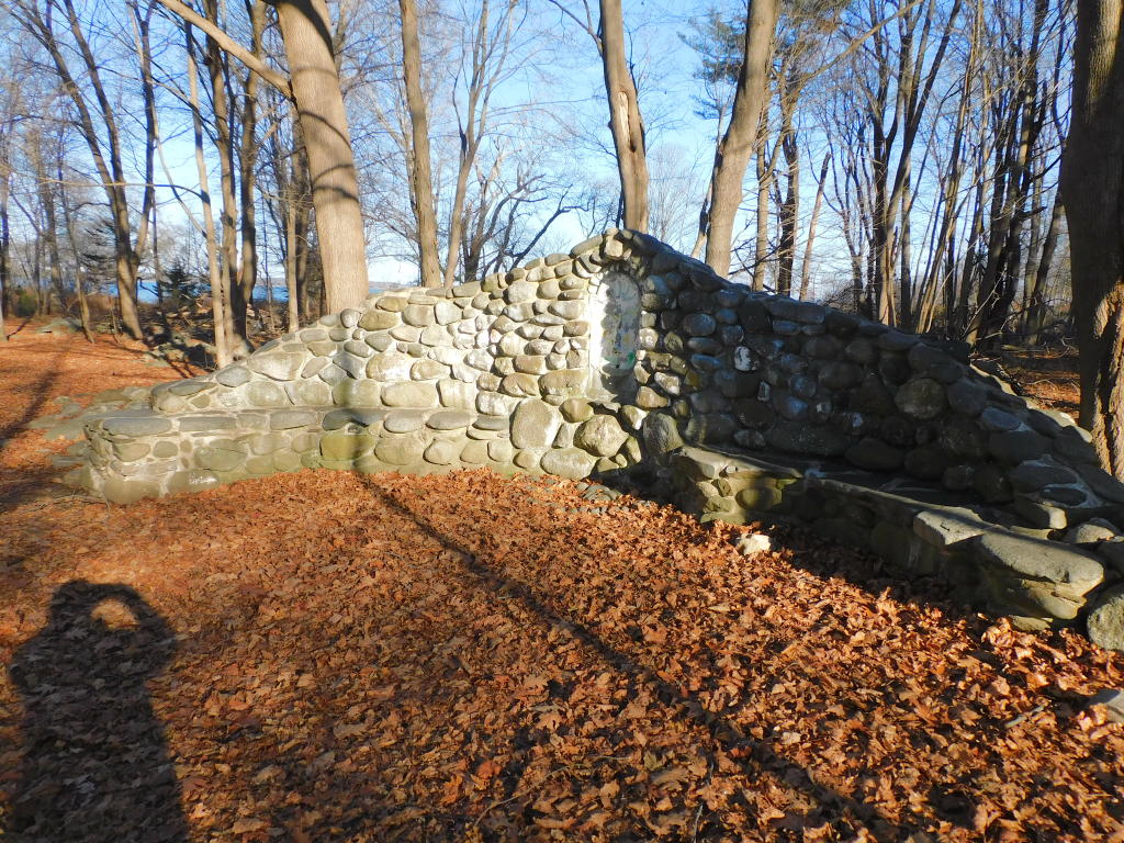
For the next 400 years, I would like to have a time machine to see how the land changed. There are rock walls every where. Fow some unexplained reason, there are steps to nowhere. There are also places to go from one area to another. There are other displays made of rock that I don’t know anything about it. It is all interesting. I did not listen to it but one can borrow a 3 mile audio tour from the science center. This may explain many of the unknown items in the point.
Eventually The land was divided up and cottages was put up near the water. Eventually, the land fell in disaray and about 1900, the federal government took over the land. The federal goverment dug up much of the historical items and baried them in a sand pit. World War I, the land was used to lauch boats for rescue missions. In World WarvII, the government built Fort Dearborn there (There is another Fort Dearborn near Chicago). This is to protect the Shipyard. There was a number of guns. There is legend that said that when they tried out the big gun, windows in Portsmouth broke from the noise. There was 18 towers built along the shoreline that had observers to tell the gun operators if they saw enemy ships. They actually saw German U-boats. One was actually brought to Chicago and put in the science museum. In 1961, they handed the land to New Hampshire for 92,000 dollars.
In 1972 the park opened up for thw public. It is now usedv for research projects and a state park. It is incredible what they did to the property. I only presented a summary of the history. To get information more detail about the history go to History of Fort Dearborn (northamericanforts.com), Odiorne Point State Park – Wikipedia, Odiorne Point State Park – Seacoast Science Center, Odiorne Point State Park – Seacoast Science Center, and Hidden History At Odiorne Point – NH State Parks. Also do a search in Microsoft Edge that has videos of the park and other web sites.

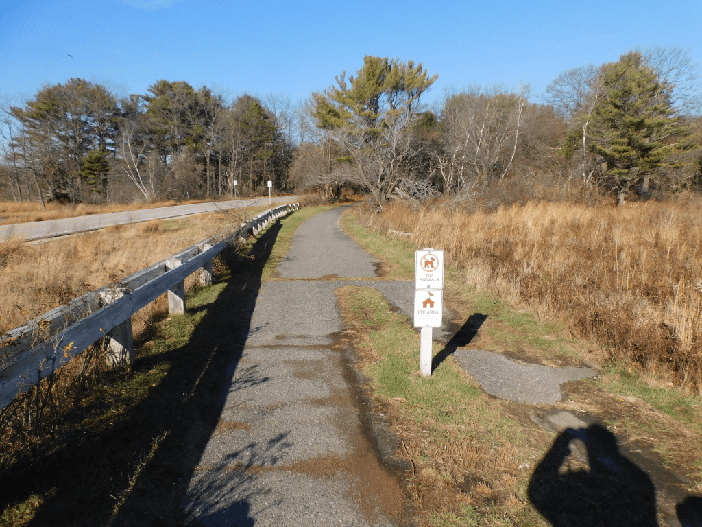
Ordiorne State Park
This is a fantastic place to visit. There are so many features there that you could spend all day there. I will probably write three blogs on this place. It not only only have great walking places, but a research center that any one one enter and much history associated with the park. I will describe the walking paths in this post and describe the other features in other post(s).
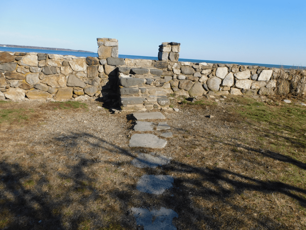
It is a state park so like most New Hampshire state parks pets are not allowed there. It costs 4 dollars for each adult to enter and 2 dollars for each child. It is well worth it. The walking paths extend throughout the park and they are well taken care of. Periodically when you are walking you run into picnic tables in the middle of nowhere. These picnic tables usually have a view of the water.
Most of the trails are flat. Many people do cross country skiing in the winter. As one walks in the park one approaches historic sites. It does have sites from where the explorers first came to New Hampshire to WWII sites. I will describe them in another post. The paths are both in the woods and along the ocean.
There is also a well equipped playground for the kids when they get bored from walking. Here are some pictures of the trails.

One can spend all day there exploring and look out over the water at the ships there and the mansions in Portsmouth and New Castle. There are also a few lighthouses in the ocean. Bring some binoculars. I also heard at times there is good fishing. I will talk more about Odiorne state park at another time regarding the history behind it or its scientific encounters. Here are some other places on the web regarding this park. NH State Parks : Welcome is a key place in the web to visit. There is a map and a video that will show the point in greater detail. I would suggest for all to come and bring food. There is no snack bar. A YOUTUBE episode is https://youtu.be/9ag_tVm1A5g. It is a man with a abbreviated journey through the park on a four wheeler. There are many others. Some good and some not. There are many short features on YOUTUBE. There is no substitute for an actual visit.
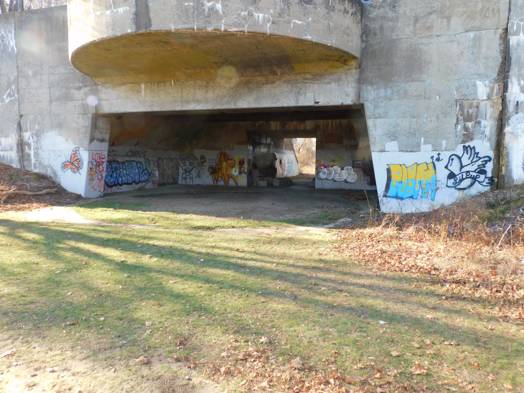
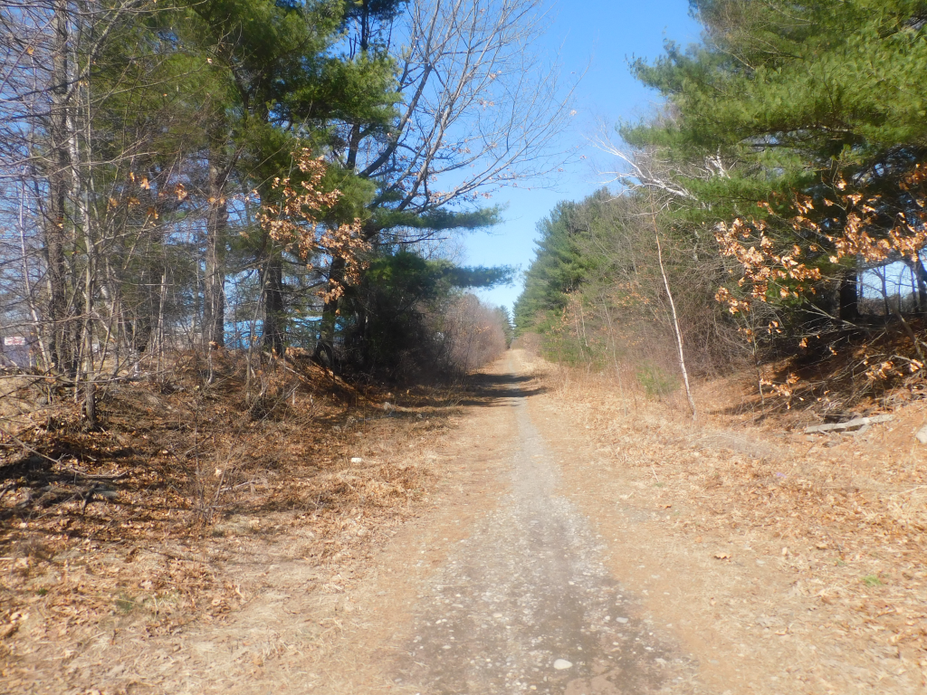
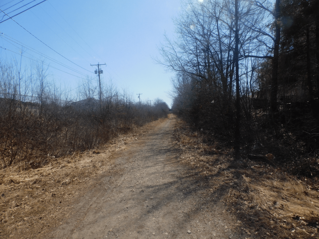
NH SEACOAST RAIL TRAIL
This is an unusual trail. Unusual because it is a trail that is not sponsored by anyone or any organization. The trail is there because it is a popular trail for walkers and bikers. There are 3 locations on the trail that I know of that hinders the trail. One is where the bridge was taken down over Drakeside road, a bridge in the marsh that was washed away (At low tide you can get through and where a stream crosses over the trail near Breakfast hill road. I saw a pool created by the stream that had about 6 blood suckers in it. It was easy to walk around the pool.
If you geocache, there is a good geocaches that is along the trail. This trail is supposed to be a part of a planned rail trail that goes from Georgia to Maine. It is a great trail to walk. It is straight with no hills. Also you don’t need to cross many roads since there are bridges to avoid the roads in most cases.
Some of the travel is very picturest especially crossing the marsh. Bring binoculars in the marsh. I’ve seen a Bald Eagle family there.
Geocache
Geocaching is a great activity to do. It can be done with your kids, a friend or by yourself. It requires walking which is good exercise. All you need is a means of transportation and a GPS. I have a GPS, but need a computer to find where on the map where the cache is located. If you have a Smart Phone and you have the internet, you can download a Geocache App and see on the phone a map on where it is located.
The people who don’t geocache are called muggles (taken from Harry Potter). The caches are hidden in just anything. Some are in ammo boxes, some in cigar containers. I found one where they used the front porch steps. Whenever you find a cache, it should have a piece of paper where you sign your cache name. The cache name is just a name you will go by when you are geocaching. It can be anyname that you can remember. One needs to register the name on the geocache website (https://www.geocaching.com)
There are clues to where the cache is. The website will tell you where it is located using latitude and longitude. The GPS will use the latitude and longitude and superimpose the coordinates on a map. It sounds complicated but with the tools in front of you, it is easy.
There are many kinds of caches. There is the standard cache where you go to the location pointed out on the computer. There are virtual caches such as the one at the petrified forest at the NH seacoast area. A real cache would be flooded out at high tide. Another one is at one of the forts in New Castle NH. They weren’t sure the requirements in Federal property to hide a cache.
Another is where you get instructions to go to the first cache. You will get numbers to insert into the coordinates of the next one and so on. In Amesbury Mass there is Geocaches like this and don’t stop until one finds all the history.
There is other styles like in the White Mountains. There is a group of caches that imitate the game Battleship. Each cache has a message the says “Miss” or “You hit my carrier”. You keep finding them until you sink the ships. Another similar to that is like in the NH seacoast area. It is called “Snow White and the seven Dwarfs.” As you find the dwarfs each will give a hint to find Snow White.”
My last one I am going to describe is the traveling bug. You buy the bug on line. You hide it in an appropriate location and record it on the web site. Another will pick it up and hide it in another location and record it. I hid one. Last I checked the bug had gone all over the country and gone a total of 5000 miles.
There are other style geocaches. You can even make up your own style. You are limited by your imagination.
There is two types of membership. There is the free membership. The is the type of membership with a small fee which you get added benefits. This is a great activity to do by yourself , family or friends.
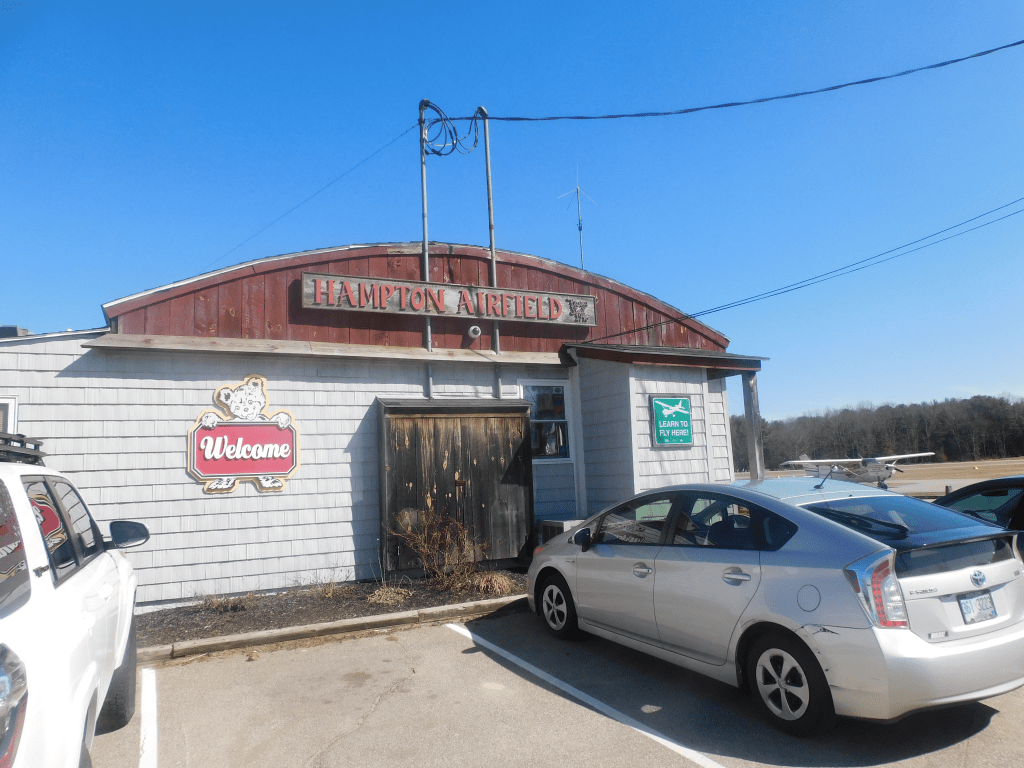
Hampton Airport
This is a great place to go to visit. The entrance is in North Hampton on the right as you travel from Hampton. It is easy to travel past the entrance. Get a passenger to keep an eye open for the entrance. The sign in the entrance is larger than previous. This is a great place to bring your family.
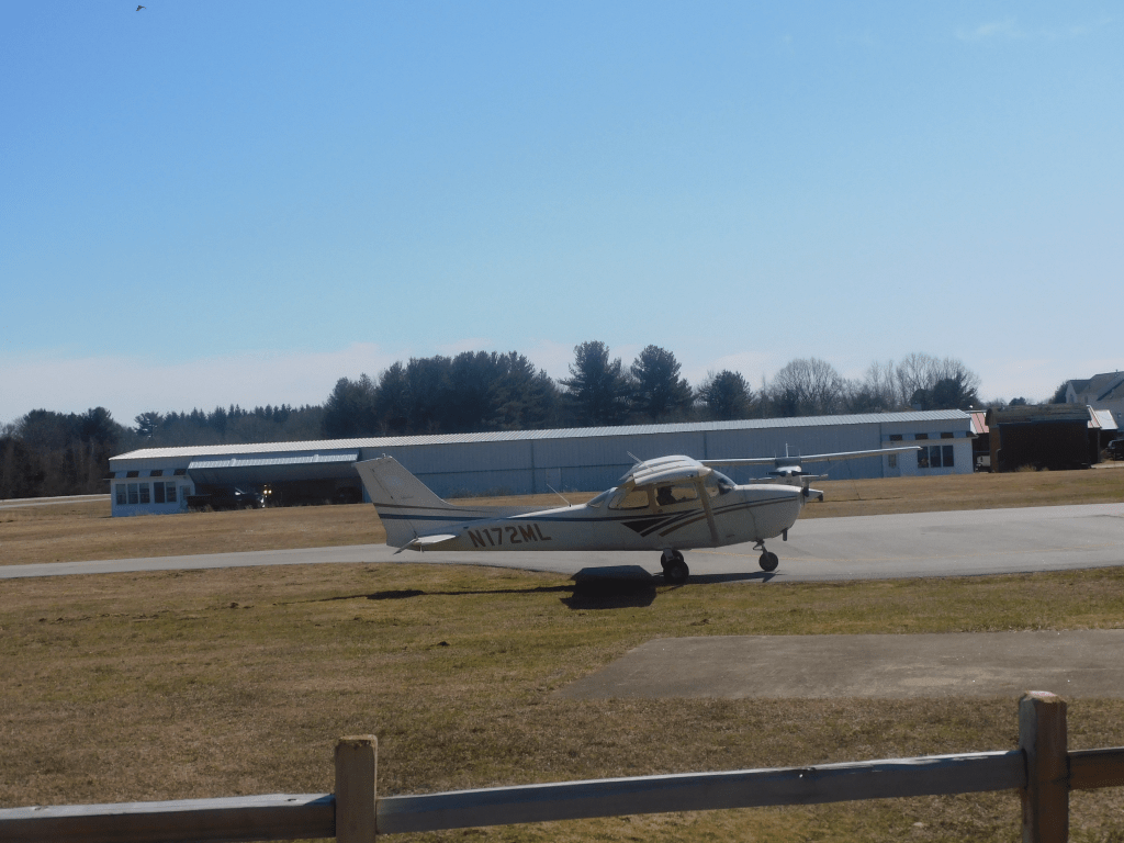
The morning is the best time to visit. That is when the pilots prepare their planes for flight. The restaurant is also open for breakfast or lunch. The food is good. To watch planes take off and land while eating is a treat. In the summer, if you’re fortunate, your can observe the planes picking up the advertising signs. Those signs you see in the sky in the summer creates a drag for the plane. There is a special technique to lift up the sign.
There are all styles of planes. There are biplanes and single wing planes. Sometimes one gets to see an ultralight. I was in the back yard and heard a lawn mower above me. Sure enough there was a very small plane with the pilot in the open flying in a small plane powered by a lawnmower engine.
If you want to do more than eat and watch planes, there are other things to do. There are people that can teach you how to fly. There are also planes that one can observe southeast New Hampshire from the sky. If you do this, I would pick a plane where the wings are on top of the plane for a better view. If you are lucky, you might find a pilot who will give you a tour of his plane.
If one catches the bug and wants to fly with their own plane, the field is a full service airfield that has gas and maintenance. It is quite an experience to visit here.