We have at least 3 posts for this blog for Odiorne point. If your interests include history, walking, boating or scientific adventures there is something of interest for you. This post is about the history of the area. Sometimes I wonder when I should start. The history is so diverse. I would love to take a time machine and see what the land looked like at different times. I see historical artifacts that I can’t explain and I can’t find someone to explain it to me. This post is about the history of the area.
Lets first look at the ice age. During the ice age the water had receded back to the Continental shelf. During that time a forest grew of what is now off the coast. The forest extended off the entire coast of New Hampshire. When the ice melted the water level raised to the level it is now flooding the forest. The forest became petrified. There is a cove on the southern portion of the point. During low tide, if you look closely you can see remnants of the petrified forest. It won’t be obvious.
Millions of years later ice melted and brought the water level to close what it is now. The forests were flooded and became petrified. Without a grasp of what previous happened, the Indians came to the point for recreation and food. There was fish , clams and mussels to eat. The Indians called this area Pannaway.
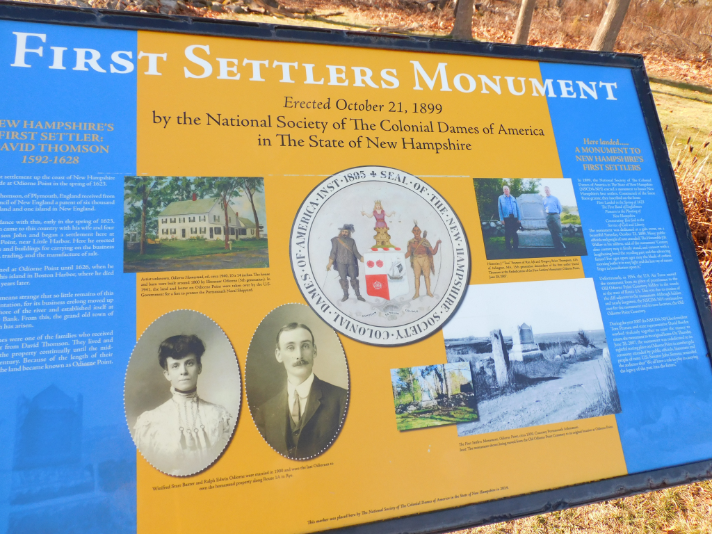
Let us look ahead further to the year 1632. This is the year when New Hampshire was first entered by Europeans. They came by ship and landed at a protruding portion of land at Odiorne point. They did not find it. A few years before the shore line was mapped by John Smith. This was the same John Smith whose life was saved by Pocahantas. He was more concerned by Isle of Shoals. If fact he name those island Smith Island and notified that of all the land that he visited in the New World he asked for ownership of the Islands. He did not live long enough to actually take control over the Island. In 1660, John Odiorne settled in the land and farmed it.
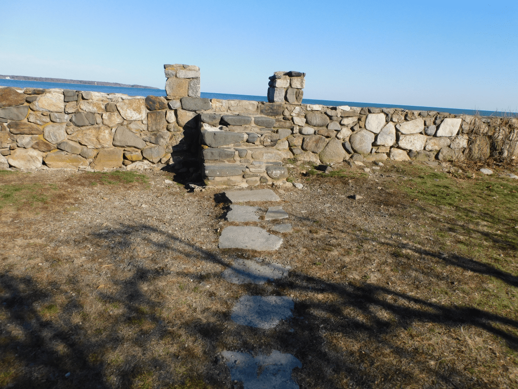
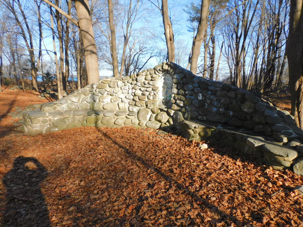
For the next 400 years, I would like to have a time machine to see how the land changed. There are rock walls every where. Fow some unexplained reason, there are steps to nowhere. There are also places to go from one area to another. There are other displays made of rock that I don’t know anything about it. It is all interesting. I did not listen to it but one can borrow a 3 mile audio tour from the science center. This may explain many of the unknown items in the point.
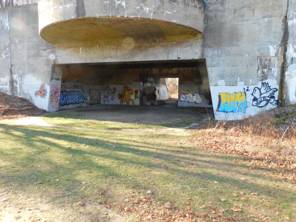
Eventually The land was divided up and cottages was put up near the water. Eventually, the land fell in disaray and about 1900, the federal government took over the land. The federal goverment dug up much of the historical items and baried them in a sand pit. World War I, the land was used to lauch boats for rescue missions. In World WarvII, the government built Fort Dearborn there (There is another Fort Dearborn near Chicago). This is to protect the Shipyard. There was a number of guns. There is legend that said that when they tried out the big gun, windows in Portsmouth broke from the noise. There was 18 towers built along the shoreline that had observers to tell the gun operators if they saw enemy ships. They actually saw German U-boats. One was actually brought to Chicago and put in the science museum. In 1961, they handed the land to New Hampshire for 92,000 dollars.
In 1972 the park opened up for thw public. It is now usedv for research projects and a state park. It is incredible what they did to the property. I only presented a summary of the history. To get information more detail about the history go to History of Fort Dearborn (northamericanforts.com), Odiorne Point State Park – Wikipedia, Odiorne Point State Park – Seacoast Science Center, Odiorne Point State Park – Seacoast Science Center, and Hidden History At Odiorne Point – NH State Parks. Also do a search in Microsoft Edge that has videos of the park and other web sites.